
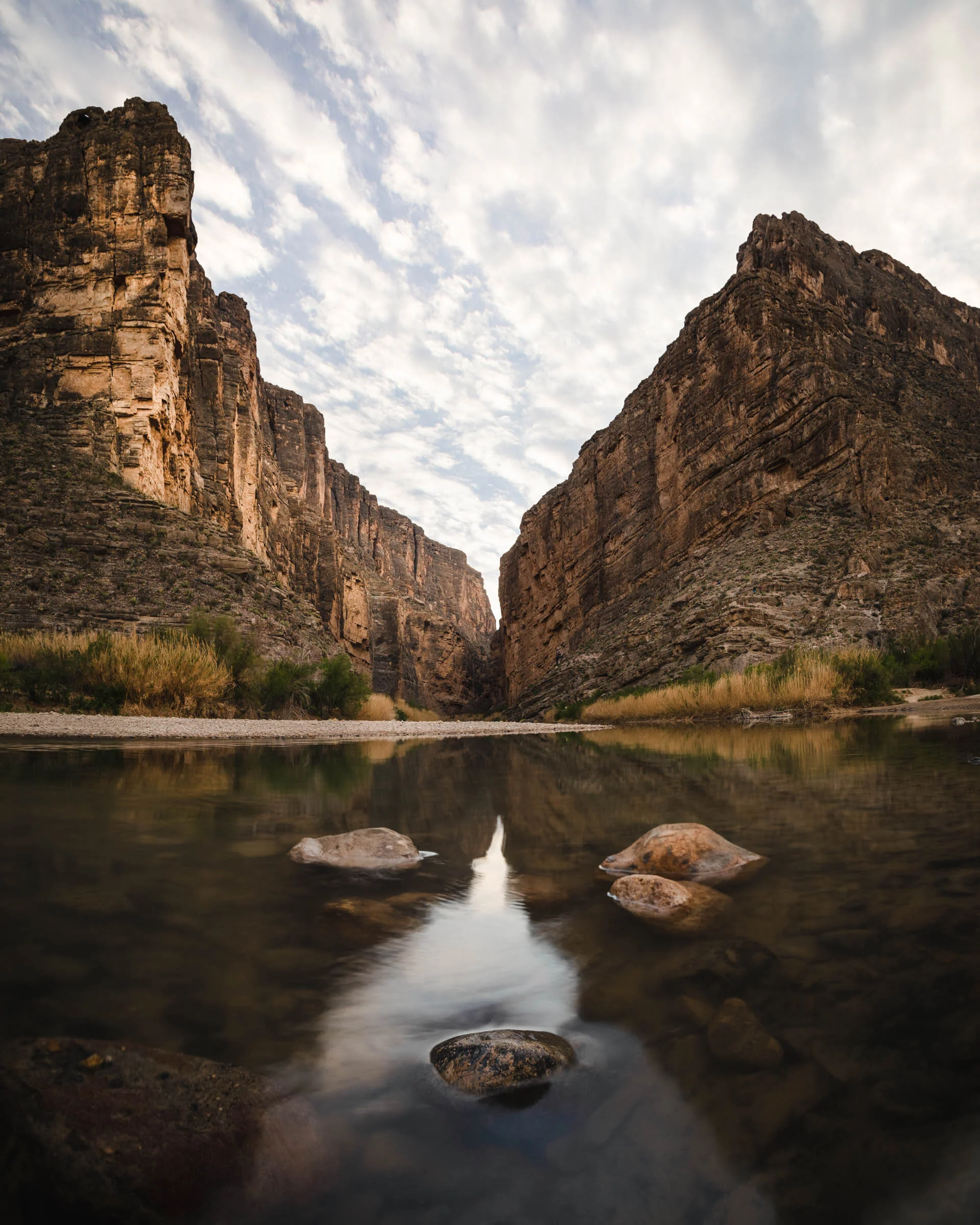
The Rio Grande River is the dividing line between Mexico and Texas. It meanders through towering canyon walls and finally opens at the mouth of Santa Elena Canyon.

As the rising sun creeps across the horizon, light begins to paint the canyon walls in Grapevine Hills.

At the southern end of Big Bend National Park, the Rio Grande river provides a unique habitat for many of the park’s native species. Likewise, the Chisos Mountains in the park’s interior harbor many plants and animals not found anywhere else in the state. I captured this image of the two together on a chilly winter morning.


The sunrises over the Mule ears vista. Scrambling up rocks in the soft glow of twilight, I found an ocotillo cactus with arms stretched to the heavens. I waited eagerly for the sunrise over the horizon to capture the bursting effect.
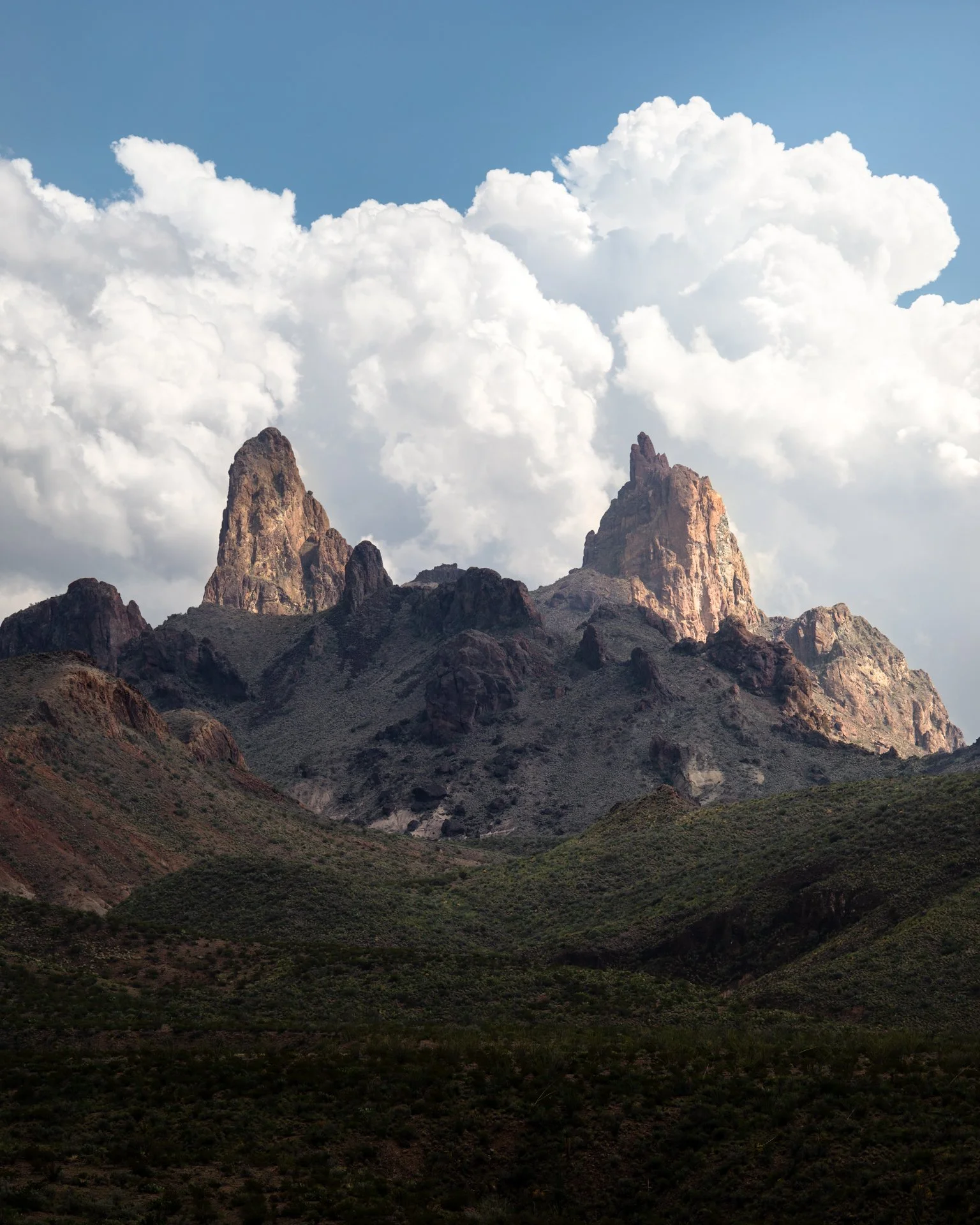
Mule Ears is an iconic formation in Big Bend National Park formed by ancient volcanic activity.

The terrain in Terlingua Texas is wild and rugged. I wanted to capture the texture of the badlands from above with Bee Mountain in the Background. This image was made with my DJI Mavic Drone at sunrise outside of town.
This print comes in a vertical orientation.

In the Grapevine Hils area of Big Bend National Park, large boulders dot the landscape. By chance, one of the boulders became lodged between two others creating the famous balanced rock formation.

During a warm August night, I ventured into the Texas hill country in search of dark skies. I found them at Enchanted Rock state park. Rated as an International Dark Sky Site, it boasts Bortle class 3 darkness. At the summit of the main dome, I found these large boulders to use for the foreground of the incoming meteor shower at night.

The South Rim of the Chisso Mountain in Big Bend, Texas. Looking out into the distance you can see the mountains of Texas and even Mexico on the other side of the Rio Grande.

The Chisos Mountains are an icon in Texas. As you drive into the mountain basin, the desert landscape slowly gives way to the woodland biome.

Overlooking the South Rim of Big Bend, Elephant Tusk is the most dominant feature in the Chisos Basin below. In the early morning, the conic rock feature carves the light around its form.

This lone tree caught my eye against the backdrop of Mitre Peak in the early morning. Orange light glows against the side of the mountain and surrounding desert landscape.
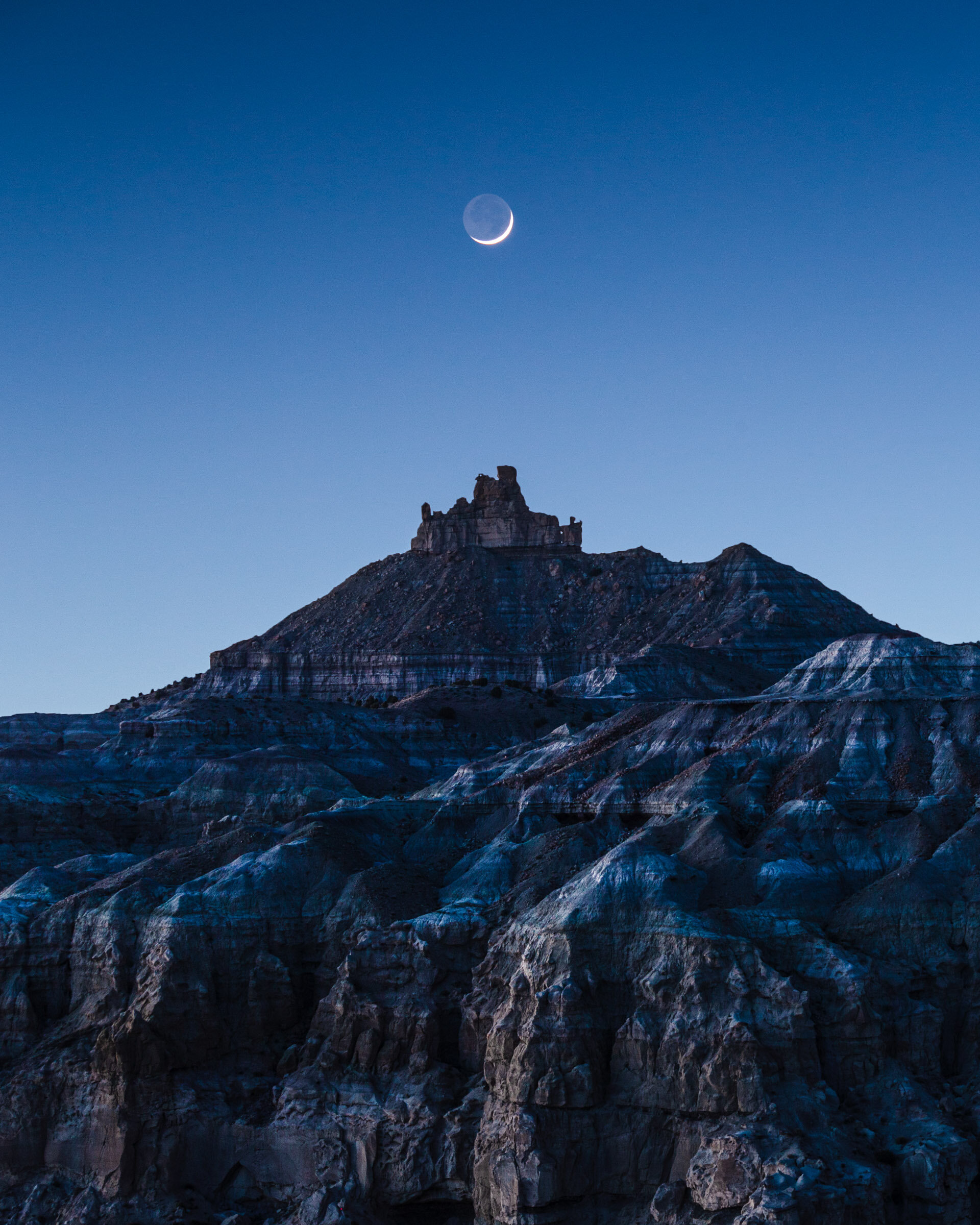
Shortly after sunset, the crescent moon fell over Angel Peak in the badlands of New Mexico.
This print comes in a vertical orientation.
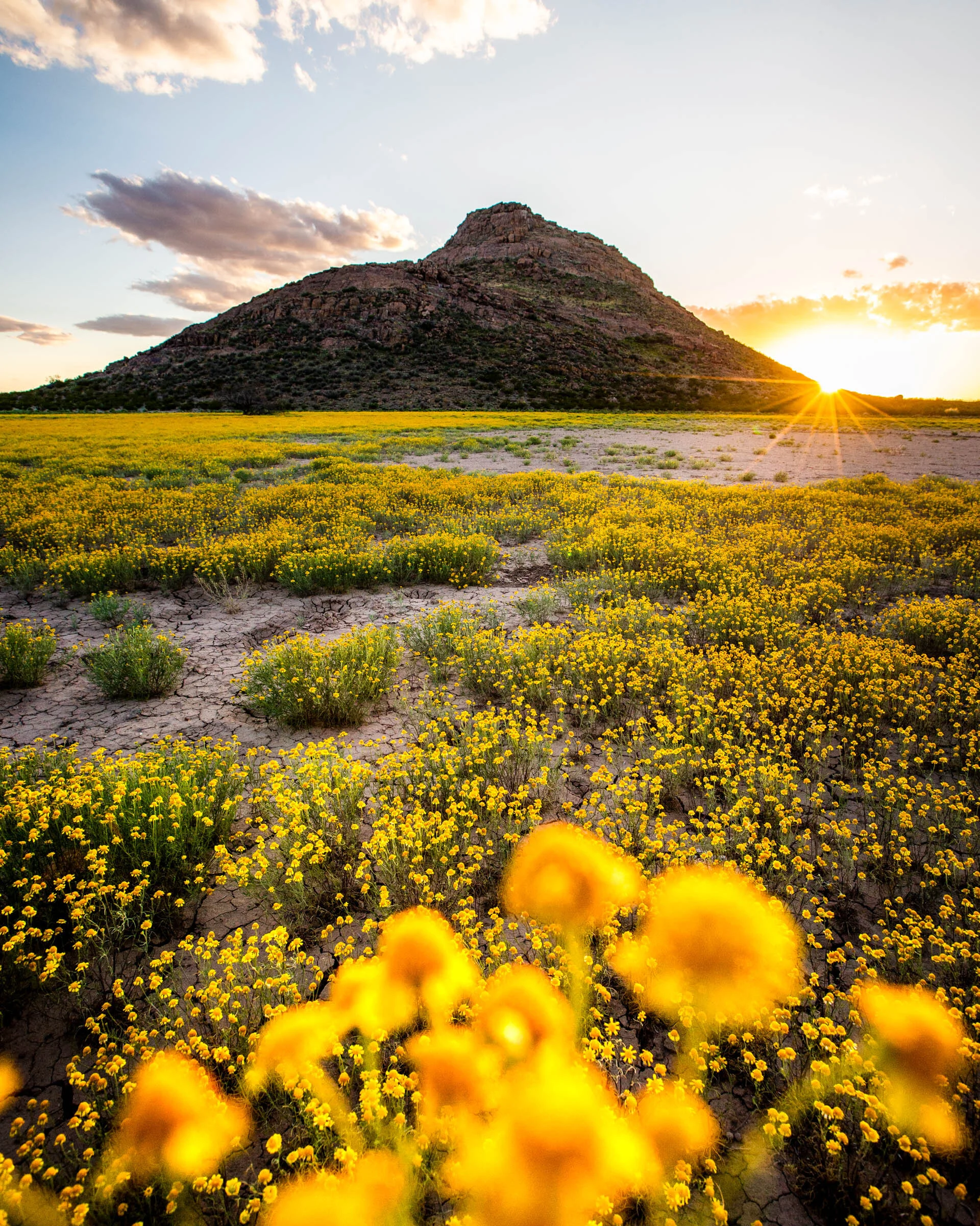
Rattlesnake Peak AKA Providence Cone in the western Dona Ana County. During the New Mexican spring, yellow flowers sprinkled the base of the mountiain.

Texas Highway 166 outside of Fort Davis completes half of the scenic 70 mile loop along with highway 118. These are some of the prettiest roads in Texas that ascend the backdrop of the Davis Mountian range and then dump into the Chihuahuan desert basin. I found this unique stretch of road on the loop which appears to roll like waves in the ocean.

The Ocotillo is one of my favorite cacti species with its alien-like appendages. They are found in abundance in the Big Bend region. I climbed up to a small hill outside the Paint Gap campsite to watch the sunset to the west.

Outside of Temple, Texas, this barn has reached iconic status among photographers. On an early January morning, I visited to capture it with the recent snow.

A piece of old wood frames the sun as it sets over the Chisos Mountains. Ernst Basin can be reached along the Old Ore Road in Big Bend with proper 4x4 drive and vehicle clearance. It’s a magical and secluded part of the park which offers many hidden gems.

Many travelers visit Arches National Park for this iconic arch. The park is largely a drive-by park, where visitors can remain in their vehicles and see most of the top attractions. However, Delicate Arch requires you to work for the view. After hiking to the arch before sunset, I set up my camera for a timelapse of the changing sky. This was my favorite exposure captured sometime after golden hour when the crowd began to die down and the sky glowed with an array of deep blue and purple colors.
This print comes in a vertical orientation.

Emory Peak is the tallest peak in the Big Bend at 7,825ft and one of the most prominent peaks in all of Texas. The sunrise and sunset from the summit provide sweeping views of the Chisos Mountains and the desert landscape beyond.

Old Baldy is an icon that draws travelers to Garner State Park. During the fall, the maples along the Frio Rio change colors in a magnificent way.

Gooseneck State Park sits on the border of Utah and Arizona. From above, it’s easy to see the deep meander of the San Juan River carved over millions of years.

The Jeff Davis Courthouse in the city center of Fort Davis. I flew my drone above this landmark in the early morning to catch the sunlight striking the west Texas town.

Devil’s Bridge is a natural rock bridge formed outside of Sedona, Arizona. A short hike in the late afternoon rewarded me with some amazing golden light as the sun slowly approached the horizon to end the day.

Angel Peak is one of my favorite desert formations in New Mexico. Located outside of Farmington, the badlands terrain drew my eye with its amazing textures and colors. In this image, the peak is basking in a warm sunset glow.


White Sands is our nation’s newest national park. The white gypsum sand dunes are the perfect blank canvas to draw your eye to sunset and sunrise lighting. Here, the sun casts powerful rays onto the dunes.
Sawtooth Mountain on Texas highway 166 outside of Fort Davis. Along the scenic loop in the foothills of the Davis Mountains, Sawtooth commands attention with its unique ridgeline.